Zoning and permits usually belong to the city, not the county, and a postal address does not tell you which. Each jurisdiction is listed on its own below; confirm the governing authority before you trust a district.
Key numbers
What this directory counts in Jacksonville
Every line below is computed from sources.json when the page is built, so it cannot drift from the entries underneath it. Each one is written to stand alone if you quote it.
- 7 official public property-records sources are listed and dated across 1 county and 1 jurisdictions in Jacksonville. Glove records source directory, Sterling Digital Partners, checked 10 Oct 2026.
- Those 7 sources are 3 parcel & appraiser, 1 zoning, 1 future land use, 1 tax and 1 recorded documents. Glove records source directory, Sterling Digital Partners, checked 10 Oct 2026.
- Tax and recorded documents still need a human in Jacksonville: not one of the 2 sources listed for them is returned by an automated lookup. Glove records source directory, Sterling Digital Partners, checked 10 Oct 2026.
- 2 of the 7 entries carry a recorded gotcha — a renamed agency, a moved path, a login wall or a jurisdiction trap found while checking. Glove records source directory, Sterling Digital Partners, checked 10 Oct 2026.
- 3 of the 7 sources are returned by Glove, 1 partly, and 3 remain a manual click. Glove records source directory, Sterling Digital Partners, checked 10 Oct 2026.
- Every entry carries its own check date; the most recent human check covering Jacksonville was 10 Oct 2026. Glove records source directory, Sterling Digital Partners, checked 10 Oct 2026.
How to read a card
What a check level means
Every card says what the last check actually did. The wording is deliberate and it is never rounded up.
- lookup completed — a named record was actually retrieved and read
- locate only — a map point was found; no attributes read
- form reached — a search form was visible; nothing retrieved
- page opened — the entry page loaded
- blocked — CAPTCHA, WAF or authority block; stated plainly
Dates are UTC and belong to the recorded check, not to this page's assembly. A date here means the page was opened and checked on that day. Our link checker runs weekly, but it only ever proposes a re-check — it cannot move a date.
The directory
Every source we have checked in Jacksonville
Duval County, FL
Jacksonville
Duval County 7 sources
Parcel & appraiser
Where do I look up who owns a property in Duval County?
This directory lists 3 checked sources for parcel & appraiser in Duval County: Duval County GIS — Parcels, Florida Statewide Cadastral — 2026 Roll and Duval County Property Appraiser.
Who owns a parcel in Duval County?
Duval County GIS — Parcels
Checked: page opened
Open the Duval County Parcels layer and read the owner and parcel ID fields; the same record's ZON_LABEL and LND_LABEL fields are also where Glove reads zoning and future land use, since Duval's GIS has no separate zoning or future-land-use layer.
You need Parcel ID (RE number)
Checked · UTC
Glove returns this A checked downtown Jacksonville address returns parcel, value, zoning and jurisdiction in about 1.5 seconds.
Where does the checked value and recorded sale come from for a Duval County parcel?
Florida Statewide Cadastral — 2026 Roll
Checked: page opened
Open the statewide cadastral roll service and join by PARCEL_ID for just value, assessed value and up to two recorded sales with their OR book and page.
You need Parcel ID
Checked · UTC
Glove returns this Supplies the value Glove returns for checked Duval County addresses.
Where do I look up the official value record at the source?
Duval County Property Appraiser
Checked: page opened
Open the Property Appraiser site and search by owner, address or RE number.
You need RE number
Checked · UTC
Your click Glove does not retrieve this; use the official site.
Zoning
Where do I check the zoning of a property in Duval County?
This directory lists 1 checked source for zoning in Duval County: FDOT Administrative Boundaries (municipal gate).
What is the zoning for a property in Duval County, and how is Jacksonville confirmed?
FDOT Administrative Boundaries (municipal gate)
Checked: page opened
Zoning is read from the county parcel record's own ZON_LABEL field, but only shown once this independent, statewide FDOT boundary layer confirms the address is inside the City of Jacksonville.
You need Address or parcel ID
Checked · UTC
Glove returns this A checked downtown Jacksonville address returns zoning along with parcel, value and jurisdiction.
Future land use
Where do I check the future land use for a property in Duval County?
This directory lists 1 checked source for future land use in Duval County: Duval County parcel record (LND_LABEL field).
Where do I check Duval County's future land use designation?
Duval County parcel record (LND_LABEL field)
Checked: page opened
Future land use is read from the same parcel record's LND_LABEL field, gated by the same FDOT boundary confirmation as zoning.
You need Address or parcel ID
Checked · UTC
Glove partly covers this Glove reads this field, but no packet field is composed from it.
Tax
Where do I check property taxes in Duval County?
This directory lists 1 checked source for tax in Duval County: Duval County Tax Collector. Glove does not return it, so this stays a manual lookup.
Where do I check property tax in Duval County?
Duval County Tax Collector
Checked: page opened
Open the Tax Collector site and search by owner, address or RE number for the current bill.
You need RE number
Checked · UTC
Your click Glove does not retrieve this; use the official site.
Recorded documents
Where do I find Duval County deed records?
This directory lists 1 checked source for recorded documents in Duval County: Duval County Clerk of Circuit and County Courts. Glove does not return it, so this stays a manual lookup.
Where do I find deed records in Duval County?
Duval County Clerk of Circuit and County Courts
Checked: page opened
Open the Clerk's official records search and search by name or document number.
You need Name or document number
Checked · UTC
Your click Glove does not retrieve this; use the official site.
Not yet harvested for Duval County: flood, permits. Know a source? Send it.
The honest part
What still needs a human
This is the most useful block on the page, so it is computed from the data rather than written by hand. Counted across Jacksonville only.
| Record type | Sources listed | Where it stands |
|---|---|---|
| Parcel & appraiser | 3 | returned in this market |
| Zoning | 1 | returned in this market |
| Future land use | 1 | a manual click in this market |
| Tax | 1 | a manual click in this market |
| Recorded documents | 1 | a manual click in this market |
Recorded documents and permits are the two that never automate cleanly. Every county clerk and every permit portal is its own small piece of software, several of them sit behind a bot challenge, and a few still want a login. If someone tells you they have all of them, ask which clerk's search they used last week.
Optional product path
Doing this every week?
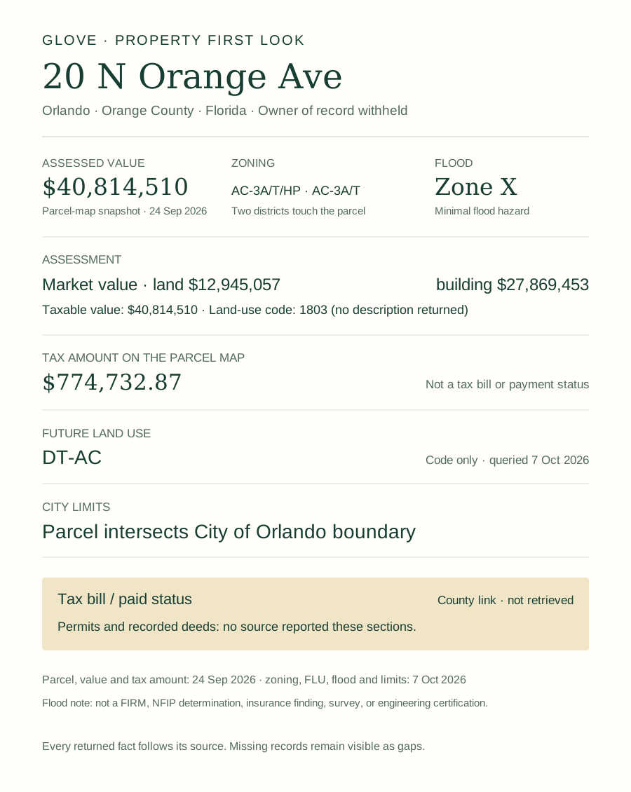
A checked downtown Jacksonville address, 100 N Laura St, returned parcel, value, zoning and jurisdiction from Duval County in about 1.5 seconds.
See what comes back in your market See a sample packet
Supported clients are Claude Code, Cursor and Codex; connection setup is required. This directory stays free and complete whether or not you ever use it.
Use the data
The whole directory, as one file
Everything on these pages is generated from a single JSON file. It is published under CC BY 4.0: use it, build on it, ship it in your own tool. The only condition is attribution.
Download sources.json Read the schema
Attribution
Klebl, C. (2026). Public property-records sources for fourteen US commercial real estate markets. Sterling Digital Partners. CC BY 4.0. https://glvtl.com/records-sources/- Entries
- 216
- Counties
- 30
- Guide pages in directory
- 14
- Last human check
Each entry carries its own checked date, so you can filter by freshness rather than trusting one number at the top.
Method
How an entry gets on this page
Each URL was opened on the date shown — by an automated HTTP fetch for most entries, and in a Chrome browser session for the Sarasota–Bradenton entries and for hosts that refuse automated requests — and what the check reached is recorded in the wording of the level key above. Nothing is listed from a search result, a press release or another directory. If a source blocked the check, it says blocked. If only the search form was reached, it says form reached. The full method, worked end to end on two real addresses, is in the Sarasota and Manatee first-look guide.
Re-verification is quarterly, with an automated link check in between. The link checker can flag that a URL moved or started returning a challenge; it cannot change a date. A date moves only when the entry itself is re-checked.
Use it & cite it
Link to this directory
Free to use and to share. If it saved you a lookup, a link back is what keeps it maintained.
Cite it
Klebl, C. (2026). Jacksonville property records sources. Sterling Digital Partners. Retrieved from https://glvtl.com/records-sources/jacksonville/
Link to it
<a href="https://glvtl.com/records-sources/jacksonville/">Jacksonville property records sources</a>, Chris Klebl, Sterling Digital Partners, 2026.
Upkeep
Corrections, and the promise attached to them
Portals move constantly and nobody tracks it publicly. If a link here is wrong, moved or now needs a login, tell us and we will check it and re-date the entry the same week. chris@sterlingdp.com — include the market, the agency and the URL. Please leave private client information out of it.
Every real move is logged in the change log, so the dates on this page can be checked rather than taken on trust. A date means the page was opened and checked that day. The link checker never moves it.